Gilboa Valley
Gilboa Valley
Under Construction
Geography of the Valley
When we talk about the Schoharie valley, most of us think of the fertile soils in the towns of Blenheim, Fulton, Middleburgh, Schoharie, and north through Esperance to the Mohawk River. Although many think of that land form as a flood plain, these valleys really are beds of sandy silt built up over eons at the bottom of glacial lakes. The flood plain is seen in the deposits of pebbles and gravel immediately adjacent to the creek itself.
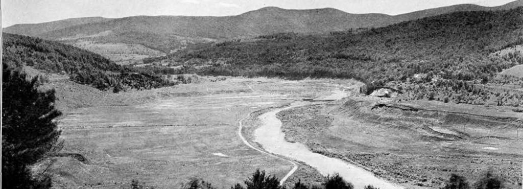
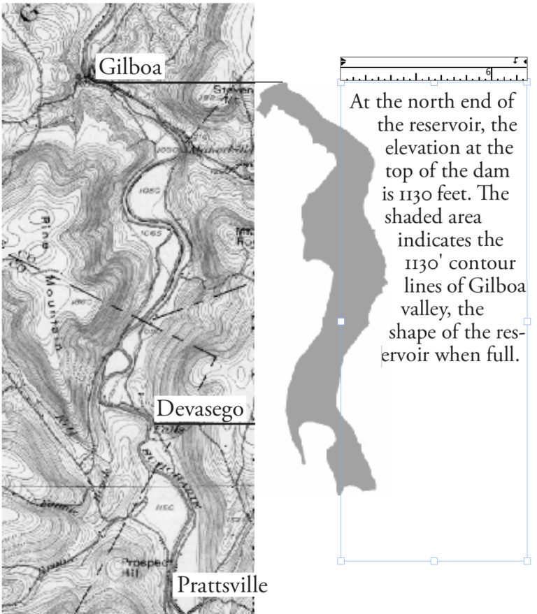
The construction site where Winifred Goldring worked in the 1920s was another Schoharie valley. The Gilboa valley was approximately six miles long and up to a mile wide, running from south to the north. Its area was about 4.5 square miles, and all water in the Gilboa valley came over 4 waterfalls. Feeding into the valley at the southern tip were Devasego Falls (bringing Schoharie Creek water from the east into the valley), and right to the west of it is the Bearkill Falls (bringing water from Delaware and Schoharie counties from the east along Route 23). The Manor Kill’s watershed in Albany and Schoharie counties was to the northeast and flows over Manorkill Falls at about the valley’s midpoint on the east side of the reservoir.
Navigating the pages of the valley and village of Gilboa
The narrower column to the right of your computer’s browser (or at the end of your phone or pad’s window) has three scroll-down windows:
- Current activities within the Gilboa Historical Society and neighborhood;
- Links to our society’s web pages (unlinked pages are shown but under construction)
- Information about the Gilboa Historical Society
- Paleo- and current history of the Gilboa Fossils
- Local history of the Gilboa valley and village
- The construction and functioning of the Schoharie Reservoir.
- Membership information
- Edit Image
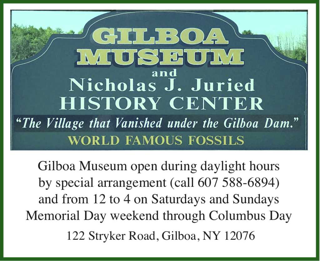
Please see our Facebook page or GilboaFossils.org for our current schedule.
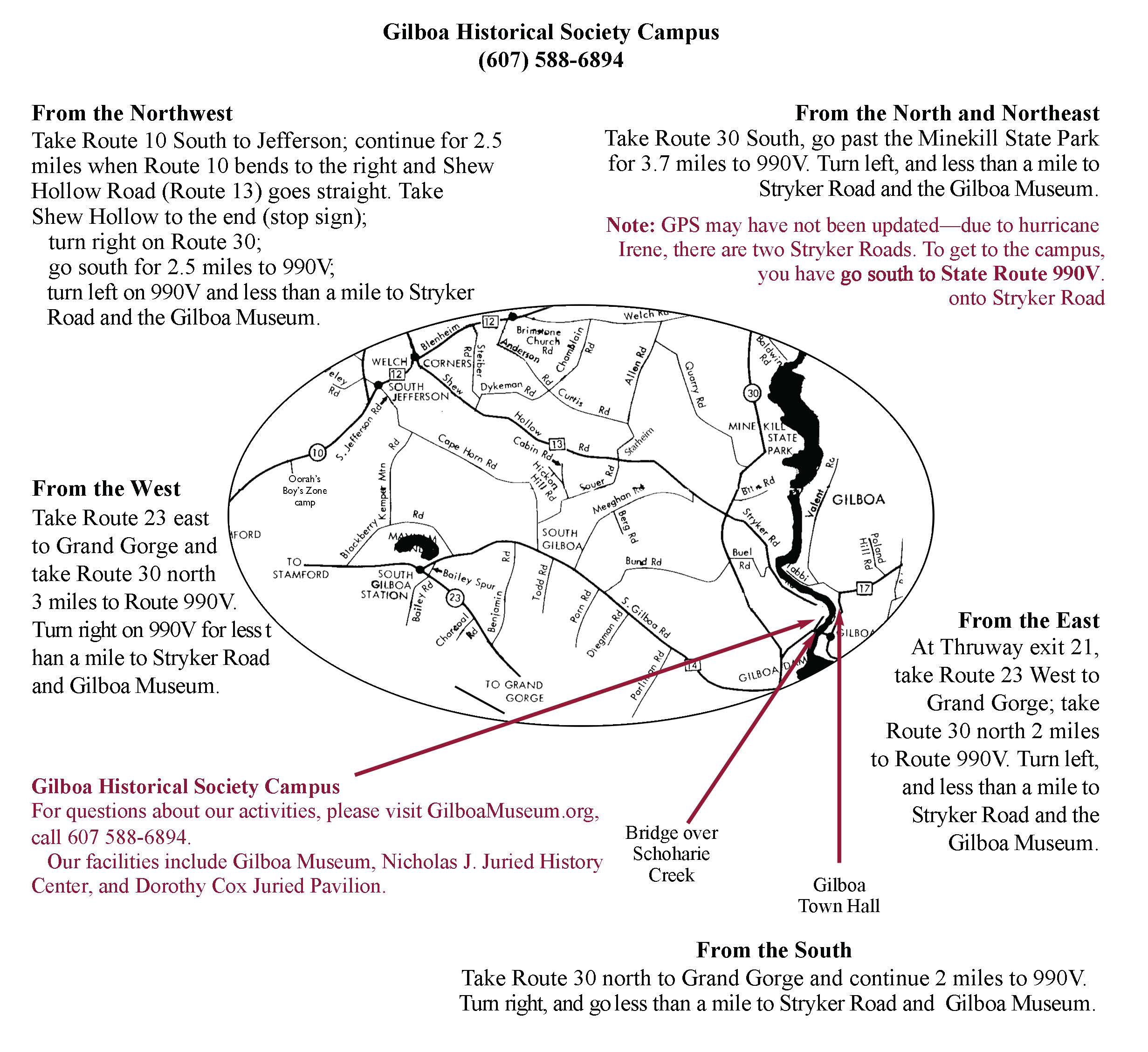
Map for the Gilboa Museum.
GHS Facebook page
GilboaMuseum
Gilboa Museum Gift Shop
GHS Founders, Early Supporters
GHS Activities
GHS Facilities
GHS — Who We Are
Publications and Podcasts
Gilboa Fossils, a site of the Gilboa Historical Society.
The fourth waterfall is often overlooked: less majestic than the Devasego, less beautiful than the Manorkill, and not as high as the Bearkill, we don’t have a name for the half-mile-long rapids bringing water from a creek along South Gilboa Road. Nevertheless, it made its contribution to the creek and the NYC Board of Water Supply called it the Steen Kill.
In old Gilboa, South Gilboa Road came into the valley from the west, accompanied by the Steen Kill. Emerging from the woods, road traffic immediately passed the creamery and onto an iron bridge crossing the creek to the old village. The Steen Kill was rerouted by the engineers so as to enter the reservoir just upstream from the west berm and dam, and you can see its bed directly across from the overlook when the water level is low.
NOTE: The western end of that iron bridge had been located where today’s western abutment of the dam can be seen.
The DEC Archives
Under construction
Economy along the valley
- Agriculture
- Other lifestyles
- Residences
Farms in the valley
- Types and size of farms
- Families of the valley
- Photo Gallery