Plans leading up to the Schoharie Reservoir
The west-of-Hudson watersheds
New York City 1895–1910
The NYC Story Around 1900
- five downstate counties had become boroughs incorporated into a single political entity—New York City.
- water resources for the city were limited to east of the Hudson locations within the 5 boroughs of the City; Westchester and Putnam counties; and the western end of Long Island.
- these sources were insufficient for the projected growth of the new metropolis.
- a new agency, the Board of Water Supply, was created to tap additional water sources.
- the BWS planned to tap the Catskill watershed for immediate relief for the city, followed soon after with additional access to the Delaware River watershed.
Step 1: To renovate existing infrastructure
- streamline the system’s distribution pipes & valves within the boroughs.
- expand the system to handle additional water.
- enlarge the Kensico Reservoir to receive Catskill watershed.
- reconstruct west Putnam County Reservoirs to receive Delaware waters.
- this would be accomplished by about 1910, although it was naturally an on-going process.
Step 2: To access the (west-of-Hudson) Catskill watershed:
- create the Catskill Aqueduct from Kensico reservoir north nearly to Kingston, and then under the Hudson River to access the waters of the Catskill Mountains. The Catskill Aqueduct has been in service since 1915.
- the largest, nearest, west-of-Hudson river was the Esopus, and a reservoir at Shokan would feed its water into the Catskill Aqueduct. The Ashokan reservoir was completed in 1915.
- smaller watersheds of the Catskill, Rondout, and Neversink creeks were considered for feeding the Catskill Aqueduct. However, these waters were not tapped until after the Depression and World War II.
- the other large Catskill watershed was the Schoharie. The plan was to construct a reservoir somewhere around Prattsville, to capture Schoharie water, channel it into a tunnel south to the Esopus Creek, and the combined water could then be channelled to the Ashokan reservoir, through the Catskill Aqueduct, and south to the Kensico Reservoir and New York City. The Schoharie reservoir started sending water south in 1924, and was fully operational by 1927.
Step 3: To access the (west-of-Hudson) Delaware River watershed:
- unrecognized from the vantage point of 1927, the remainder of New York City’s plans were delayed.
- once the Catskill watershed was complete, the plan had been to access the Delaware River watershed using enlarged storage reservoirs in northwestern Putnam County. From that point, a tunnel would be drilled northeast under the Hudson and then to a small reservoir formed by a dam on the Roundout River. This staging area could then be connected to the two branches of the Delaware River.
- in the chief engineer’s annual report of 1925, the BWS projected that New York City would be in worse shape in 1935 than it had been in 1905. The Putnam County reservoirs had been prepared to receive these projected waters, but the Depression of 1929 and the advent of World War II stopped all further work.
- after VE Day, work on the BWS sources were continued, with two small watersheds sending emergency water through the Delaware aqueduct in the 1950s. The final plans were finally achieved with the completion of the Pepacton reservoir in 1955, and the Cannonsville in 1967.
Summary of west-of-Hudson River waters:
Chronologically, there are 6 large, west-of-Hudson infrastructures:
- Ashokan Reservoir & Catskill Aqueduct 1915
Impounds Esopus Creek
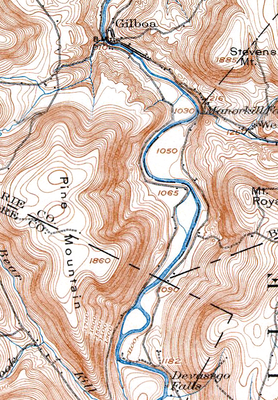
Communities Flooded (8): Shokan, Broadhead’s Bridge, Brown’s Station, Olive Bridge, West Hurley, Glenford, Olive, Ashton - Gilboa Reservoir & Shandaken Tunnel 1927
Impounds Schoharie Creek
Communities Flooded (1): Gilboa - Rondout Reservoir & Delaware Aqueduct 1951/1954
- Impounds Rondout Creek
Communities Flooded (3): Eureka, Montele, Lackawac - Neversink Reservoir & Tunnel 1950/1954
Impounds Neversink River
Communities Flooded (3): Neversink, Bittersweet, Aden - Pepacton Reservoir & East Delaware Tunnel 1955
Impounds East Branch of the Delaware River
Communities Flooded (4): Arena, Pepacton, Shavertown, Union Grove - Cannonsville Reservoir & West Delaware Tunnel 1967
Impounds West Branch of the Delaware River
Communities Flooded (5): Beerston, Cannonsville, Granton, Rock Rift, Rock Royal
(opens in a new tab)(opens in a new tab)w, but
- Edit Image
Please see our Facebook page or GilboaFossils.org for our current schedule.
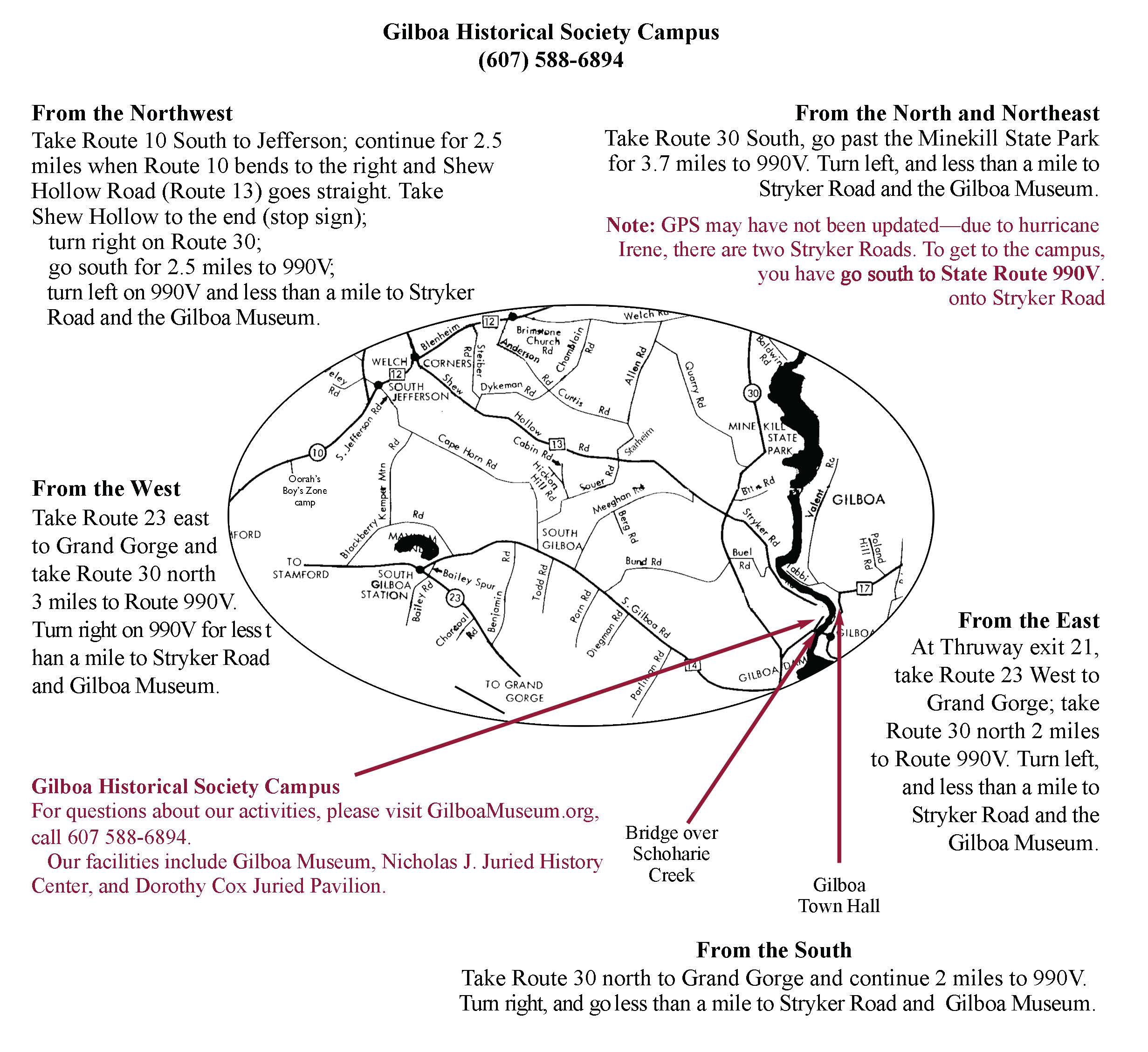
Map for the Gilboa Museum.
GHS Facebook page
GilboaMuseum
Gilboa Museum Gift Shop
GHS Founders, Early Supporters
GHS Activities
GHS Facilities
GHS — Who We Are
Publications and Podcasts
Gilboa Fossils, a site of the Gilboa Historical Society.