The Schoharie Reservoir
Why Gilboa?
Under Construction
The Nature of a River
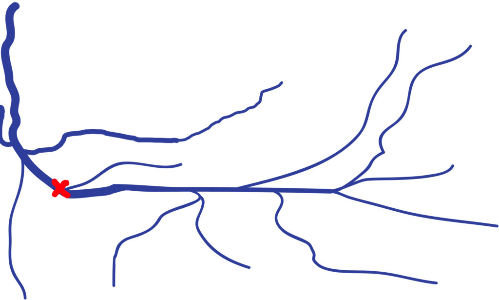
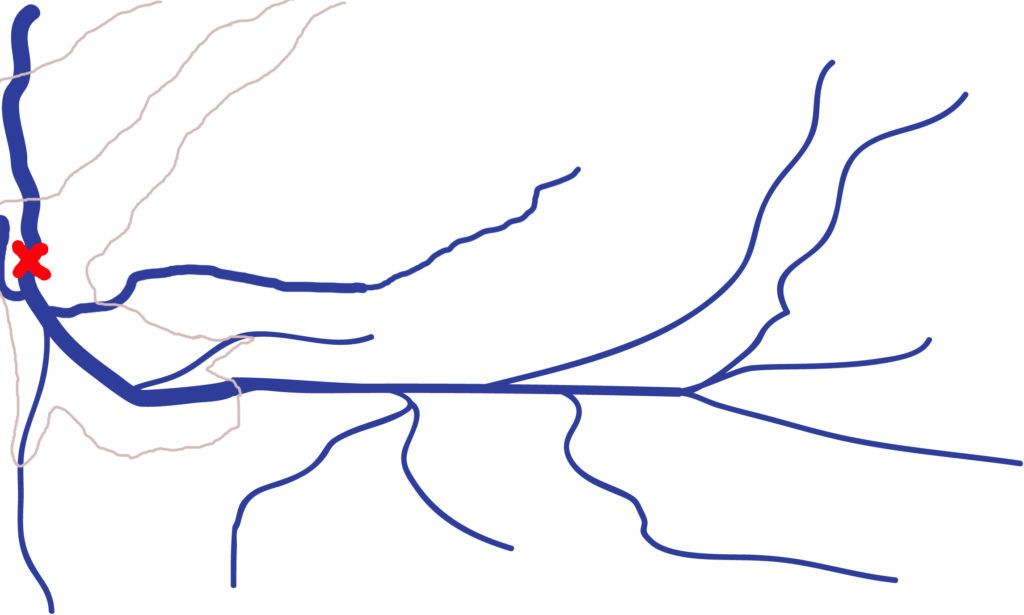
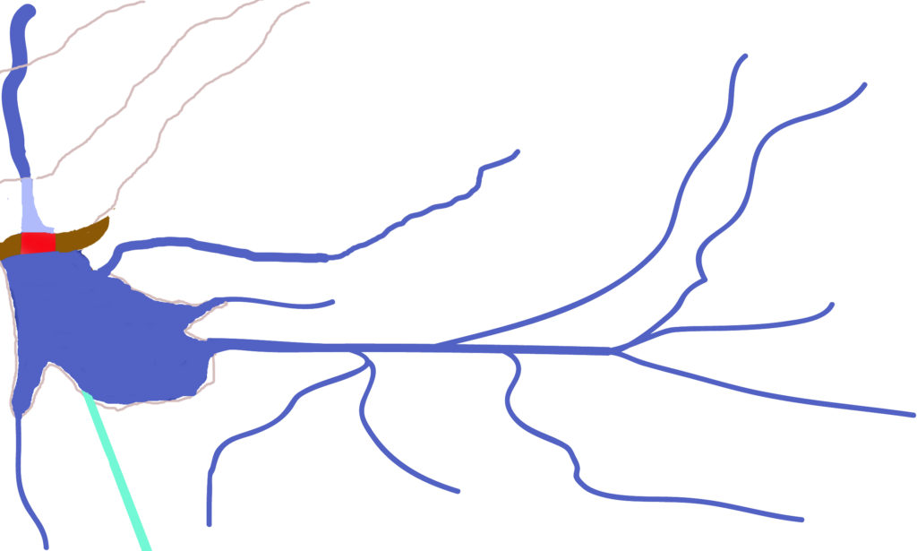
Headwaters: A river is fed by a network of tributaries that typically has steep drops in elevation making water move quickly downstream in relatively deep, narrow beds. Engineers have problems in this area because a heavy rain can stress the land while not providing a lot of water. In the three sketches of the Schoharie below, the headwaters would be to the right of the watershed.
Midreaches: As the river enters more level ground, it looks more like a river with larger amounts of water flowing at more moderate speeds in a broader, shallower channel. A good location for a midreach dam is in the left picture, marked with a red “X“
Mouth: The end of a river typically meanders in a flood plain. It has the greatest volume of water, slower speeds, and runs in a broad but shallow bed forming a delta. You rarely see man-made dams in a delta because the land form does not provide a natural bowl for the collection of water.
The locations for dams generally are in a river’s midreach. Engineers will find easier construction on the upstream side due to narrower, deeper channels; but one needing more water would go downstream for additional tributaries at the cost of possibly greater construction costs.
Spoiler Alert: In the case of Gilboa, they found Gilboa downstream from Prattsville (X in the middle picture), and built the dam where they could access additional water from the Bear Kill, Manor Kill, and Steenkill (right picture).
(opens in a new tab)-


The Situation in 1914
- By the end of 1914, it was apparent that the Ashokan reservoir’s actual production plus Prattsville’s projected flows would not be enough water to run the Catskill Aqueduct at full capacity.
- The Schoharie creek flows west from the Hudson escarpment through Prattsville, and then turns to flow north into the Gilboa valley. The upstream boundary of the valley is marked by the 50-foot tall Devasego Falls.
- The valley itself has a south-north length of about 6 miles, with the village of Gilboa on the east shore perched on a 35-foot-high ledge. The village overlooks the Gilboa rapids at the north end of the valley.
- The valley basin is about 4.5 mi.²
- The Manorkill and Bear Kill waters both pass over tall waterfalls to get into the valley.
- The Steenkill waters join the Schoharie Creek over a long set of rapids just north of the projected dam
- A reservoir created by a dam located at the Gilboa falls has these benefits:
- The shape of the valley was a natural bowl with a depth of over 50 feet.
- The only constructed reservoir walls would be a narrow berm to the east, the dam itself, and a wider berm to the west to encircle Schoharie water.
- The Gilboa location would provide more water than one at Prattsville.
- The under-Hudson aqueduct could be run at full capacity in conjunction with Esopus water.
- The construction and maintenance costs of the relatively small Gilboa reservoir would be less than for a larger Prattsville one.
- Offsetting the above point, the Shandaken tunnel from Gilboa would be about 10% longer from Prattsville.
- Overall, the construction and maintenance costs (reservoir and tunnel) for Prattsville versus Gilboa were about equal.
- Edit Image

Please see our Facebook page or GilboaFossils.org for our current schedule.
Map for the Gilboa Museum.
GHS Facebook page
GilboaMuseum
Gilboa Museum Gift Shop
GHS Founders, Early Supporters
GHS Activities
GHS Facilities
GHS — Who We Are
Publications and Podcasts
Gilboa Fossils, a site of the Gilboa Historical Society.